Construction Inspection

Restore urban planning at a fraction of the cost and time with our drone-powered solutions!

sliderImage
a map of a housing complex

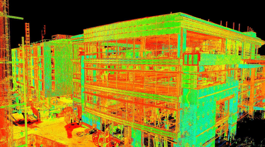
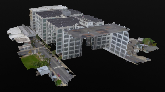
Our drone cameras, equipped with high-quality features, provide detailed project inspections and are more economical than traditional methods. Equipped with LiDAR scanners, they produce three-dimensional representations. These UAV technology and sensors provide accurate topographical data, aiding clients in energy efficiency, project monitoring, sewage design, utility establishment, and detecting illegal constructions and encroachments.

Our Features

a green helmet and goggles
We employ high-end surveying drones with cutting-edge sensors to generate extremely precise topographical data.
a green clock with a dollar sign
To handle and analyze the data from the drone survey, we have a team of GIS experts working around the clock to deliver on schedule.
a green gear with a check mark in it
From the beginning to the end of the project, we offer our clients every support imaginable and work with them to improve their decision-making using survey data.

We Can Help with

Data Collection

Traditional inspection methods often require significant workforce and time investment, leading to increased costs. However, UAVs equipped with high-resolution cameras, video cameras, thermal cameras, LiDar sensing, and ferromagnetic sensors are emerging as the future of the industry.

3D Model Visualisations

Augmented reality on consumer devices, using pix 4D software for 3D visualization, can transform drone-captured images into valuable public engagement tools. The mapping software can help buildings be superimposed into their surroundings, providing essential design understanding.

Aerial Surveys/Basemaps

Drones with high-resolution cameras, video cameras, and thermal cameras have revolutionized navigation and mapping of complex urban and rural projects. This technological advancement is quicker and sustainable, and has led to the use of virtual reality.

Data Collection

Drones are increasingly crucial for architects and planners due to their low altitude operations and high spatial resolution. They enable comprehensive traffic analysis, enabling planners to easily remodel and craft cities, and provide insights for various applications through video analysis.
a green helmet and goggles
Improve Protection

Drone inspections reduce accidents and ensure safer working environments by eliminating human access. Drones equipped with cameras and other sensors can be used for surveillance and monitoring purposes.

a green clock with a dollar sign
Cost and Time Savings

Drones have the potential to reduce costs and save time in various industries and applications due to their ability to perform tasks more efficiently and with less human intervention.

a green gear with a check mark in it
Comprehensive Coverage

Drones can provide comprehensive coverage in various applications and industries, thanks to their ability to access difficult-to-reach areas, capture high-resolution data, and operate in a versatile manner.

a green triangle with a exclamation mark
Early Detection

Early detection using drones refers to the use of unmanned aerial vehicles (UAVs) equipped with various sensors and technology to identify and respond to specific events or conditions at an early stage.